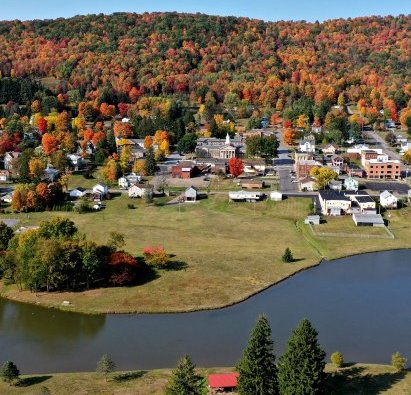
So Much to See and Do in Any Season
The route follows Pennsylvania Bicycle Route Y, and showcases amazing natural beauty and many man-made wonders including the Kinzua Sky Walk, the first steam locomotive, the Zippo lighter, and the first lighthouse on the Great Lakes.
Information & Maps about U.S. Bicycle Route 36
Trail Association of the McKean/Elk Divide (TAMED)
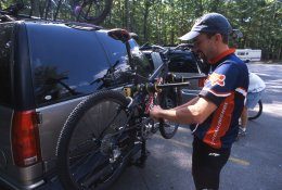
In the Allegheny National Forest, mountain bikes are permitted on all forest roads, all ATV trails, and most hiking and cross-country ski trails.
Trails – Shared Use with ATV
Willow Creek – 10 miles, more difficult
Marienville – 23.1 miles, most difficult
Rocky Gap – 21.9 miles, most difficult
Timberline – 39 miles, easiest
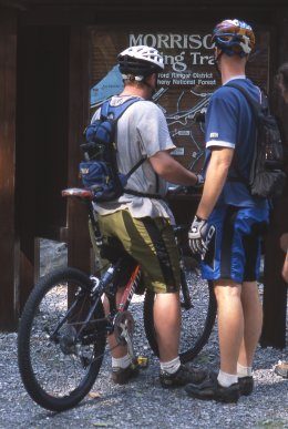
The Map of the Morrison Trail shows a 10.8-mile loop. Passing through open hardwood forests and large rock formations, the ground cover along the trail is thick with Mountain Laurel. The trailhead parking lot is located along Rt. 59, 17 miles west of the Bradford, PA.

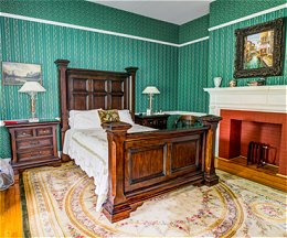
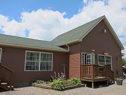
Enjoy two nights stay at the Kane Manor Inn and sample the local fare and libations including a $50 voucher at Table 105, Kane’s foremost American bistro, wine tasting/meat and cheese tray at Flickerwood Winery ($15 value) and beer tasting or two full glasses of craft beer at our local Logyard Brewing ($12 value). Kane, PA is Trail Central™ and located on the Knox & Kane Rail Trail (2 blocks from the Inn) and adjacent to numerous trails for hiking, biking and winter sports. The total package is $299.00 plus tax for two adults.
Kane Manor Inn
230 Clay St.
Kane, PA 16735
814-837-6522
kmi@kanemanorinn.com
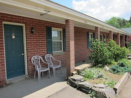
Lantz Corners Getaway is centrally located to all the great fishing areas. Fishing for Value Package includes one overnight stay and one $10 food & beverage voucher for the Barrelhouse Restaurant – all for only $70.00 plus tax. Phone for reservations at 814-778-5391, and mention the Fishing for Value Package for this special pricing. Extended nights & group pricing also available.
Lantz Corners Getaway and Conference Center
Intersection of Rt. 219 & Rt. 6
2952 Route 219
Kane, PA 16735
814-778-5391
lantzcornersgetaway@yahoo.com
Stay 2 nights and get 1 night free. Fee is $140.00 + tax for one person, or two people sharing a room. Walk to the Barrelhouse Restaurant & Pub next door, serving breakfast, lunch & dinner. Spend the evening relaxing around the fire pit. Call for reservations at 814-778-5391, and mention this Fly & Drive package for special pricing!
Lantz Corners Getaway and Conference Center
Intersection of Rt. 219 & Rt. 6
2952 Route 219
Kane, PA 16735
814-778-5391
lantzcornersgetaway@yahoo.com
Midweek Adventure Package
Package includes one night lodging at a Holiday Valley Property and a 3 hour Aerial Adventure starting at $249 for two people, midweek, tax included. Packages are available at the Inn at Holiday Valley, the Tamarack Club or a Holiday Valley Rental Management property.
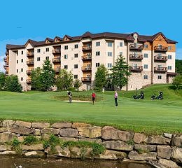
The Inn at Holiday Valley
6081 Route 219 South
Ellicottville, NY 14731
716-699-2345
aneal@holidayvalley.com
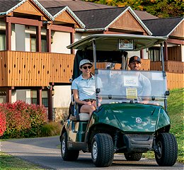
Midweek Golf & Stay Package
Stay at the Inn and enjoy 2 days of golf with 18 holes per day, plus club cleaning and storage, and unlimited range balls at our practice facility. Up to two kids age 17 and under stay free. $549 for 2 nights for 2 adults.
Lodging is available at the course-side Inn at Holiday Valley, the course-side Tamarack Club and area condominiums, townhouses and homes managed by Holiday Valley.
The Inn at Holiday Valley
6081 Route 219 South
Ellicottville, NY 14731
716-699-2345
aneal@holidayvalley.com
Stay at the Best Western Bradford Inn, located within walking distance of downtown restaurants. Package includes 2 nights lodging, free hot breakfast bar, 4 bottles of bottled water, two ANF decals, and a bag of trail mix. $225.00* for 2 Adults, 2 nights.
* Does not include tax.

Plus Bradford Hiking Package – Bradford, PA
Best Western Bradford Inn
100 S. Davis Street
Bradford, PA 16701
814-362-4501